 Image 1 of 1
More Info:
Image Dimensions: 10500 × 6081 px
Location: Tonto National Forest, Lower Salt River Area.
Note: This image is exclusive to this site. © 2026 Ray Redstone
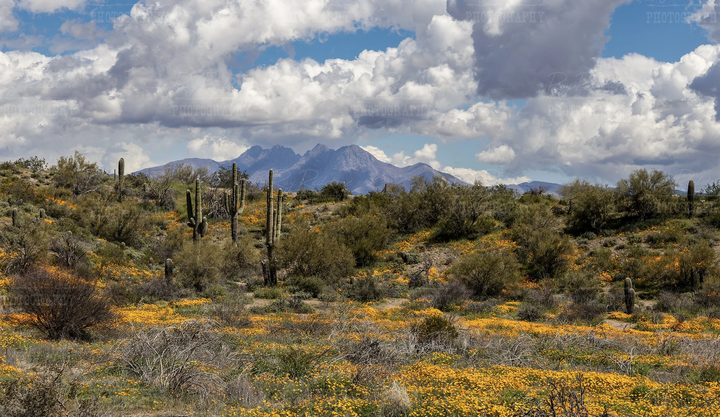
Captured in the Tonto National Forest during the wildflower super bloom of 2023, this wade ratio landscape image feature vibrant wildflowers like Mexican Poppies with the iconic Four Peaks mountain range in the background.
Four Peaks is a prominent mountain group in the Mazatzal Mountains of central Arizona, located east of Phoenix near the towns of Fountain Hills and Carefree. The four highest summits—Brown’s Peak (the tallest at 7,659 feet), Brother Peak, Sister Peak, and Amethyst Peak:—form a rugged, widely recognized skyline visible from the Phoenix metropolitan area.
Key points:
Elevation: Brown’s Peak reaches 7,659 ft (2,334 m).
Geography: Steep granite ridges, deep canyons, and mixed conifer and chaparral vegetation; part of Tonto National Forest.
Recreation: Popular for hiking, backpacking, trail running, rock climbing, and winter snow play on higher slopes. The Brown’s Peak trail (via the Four Peaks Trail) is the most commonly used route to the summit.
Hydrology: The range captures monsoon and winter precipitation, feeding local creeks and reservoirs.
Access & safety: Trails can be steep and exposed; summer heat, lightning during monsoon season, and variable winter conditions require proper preparation, water, and navigation skills.
Cultural note: Four Peaks is a well-known landmark and appears on the Arizona state quarter design inspiration; it also holds significance for local communities and outdoor enthusiasts.
More Info:
Image Dimensions: 10500 × 6081 px
Location: Tonto National Forest, Lower Salt River Area.
Note: This image is exclusive to this site. © 2026 Ray Redstone