What is the best Difficult hike in Scottsdale, AZ?
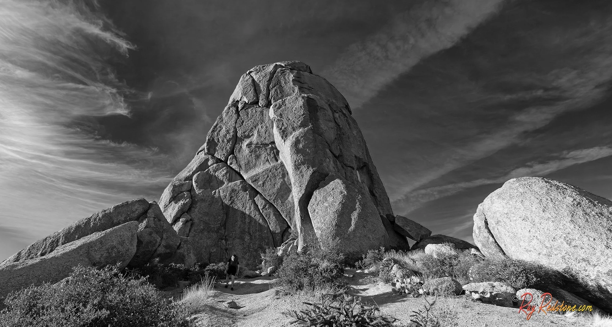
This is the cool rock formation and landmark at the end of the trail that this trail is named after- Toms Thumb.
What Is The Best Strenuous Or Difficult Hiking Trail In Scottsdale AZ? | An Avid Hiker And Photographer’s Opinion
If you’re searching for the most rewarding challenging hike in Scottsdale, there’s one trail that consistently rises above the rest—Tom’s Thumb Trail in the McDowell Sonoran Preserve.
As an avid hiker and outdoor photographer who has explored most of the major hiking trails in Scottsdale, I can confidently say this trail offers one of the best combinations of difficulty, panoramic scenery, and unique geological character anywhere in the Phoenix metro area. It’s not an easy trek—but that’s exactly what makes it so memorable.
Why Tom’s Thumb Trail Is Considered Difficult
Let’s start with the reality: this hike earns its “strenuous” or “difficult label” label.
The out-and-back trek to Tom’s Thumb is roughly 4.4 miles round trip from the trailhead , with approximately 1,200 + feet of elevation gain. What makes it especially demanding isn’t just the distance—it’s the grade. The trail steadily climbs a good portion of the way, with long stretches of exposed switchbacks that can feel relentless, especially under the Arizona sun.
There’s very little shade along the route, which means heat becomes a major factor for much of the year. Even experienced hikers can find this trail taxing if they’re not properly hydrated, prepared with enough water, and take proper timing into consideration. My recommendation is to start this hike as early as possible in the morning for cooler temps and occasional shaded sections. I try to hit the trail as soon as electronic gate opens at the trailhead entrance opens in the morning to enter the parking area which is usually about 15 - 20 mins before sunrise.
Add in uneven terrain, rocky footing, and sections that feel steeper than expected, and you’ve got a hike that will test your endurance. But if you’re in decent shape and enjoy a good uphill challenge, this is exactly the kind of trail that leaves you feeling accomplished. I highly recommend bringing trekking poles for extra stability which can come in handy especially for breaking at times heading back down steep sections of this trail.
A Photographer’s Dream: Why It’s Worth the Effort
Here’s where Tom’s Thumb separates itself from other difficult hikes—it rewards every step of the climb.
From early on, the trail opens up to expansive views of the Sonoran Desert. As you gain elevation, the scenery becomes more dramatic, revealing rolling desert hills, distant mountain ranges like the famous Four Peaks Range, and sprawling valley views that stretch across Scottsdale and beyond.
For photographers, this trail is loaded with scenic opportunities.
Golden hour here is especially magical. The warm desert light paints the granite formations in shades of orange and pink, while long shadows add depth and texture to the landscape. Sunrise hikes offer crisp air and soft light, while sunset brings bold colors and dramatic skies—both are worth experiencing. It is possible to see the sun rising on this trail but you need to get to the trailhead as soon as it opens to reach the base of the mountain and quicky start heading up…
Unique Geology: The Iconic “Thumb” and Beyond
One of the standout features of this hike is its fascinating geology.
The trail leads you toward the striking granite formation known as Tom’s Thumb—a prominent rock spire that rises dramatically from the surrounding landscape. It’s one of the most recognizable landmarks in North Scottsdale and serves as a visual anchor for the entire hike.
I have often told people that when you get into the upper reaches of the trail with all its massive boulders and spooky outcroppings it literally feels like you are hiking in an alien landscape and world.
In addition, if you explore the nearby Marcus Landslide Trail, you’ll encounter a massive boulder fields and evidence of ancient geological activity. The landslide area is filled with enormous granite slabs that appear frozen in motion, creating a rugged and almost otherworldly environment.
For anyone interested in desert geology—or just looking for something visually unique—this area delivers big time….
Trailhead Location and Amenities
The hike begins at the Tom’s Thumb Trailhead, located off North 128th Street in Scottsdale.
One of the things I appreciate most about this trailhead is how well-maintained and hiker-friendly it is and the abundant parking it offers.
Here’s what you can expect:
Ample Parking: There are several large paved parking lots that can accommodate a good number of vehicles. Unlike some other popular trailheads in North Scottsdale like Pinnacle Peak and Browns Ranch, there always seems to be parking spaces available here.
Restrooms: Clean, permanent restroom facilities are available—always a big plus before and after hitting a strenuous trail.
Seating & Ramadas: Beautiful designed to compliment the rugged Sonoran desert landscape, the trailhead building offers airy and shaded seating areas that provide a comfortable place to prep your gear or relax after your hike.
Trail Maps & Signage: Clear signage and posted maps make navigation straightforward, even for first-time visitors.
Dog Friendly: Dogs are allowed but must be leashed at all times. Its important to note again that there is no water at the trailhead here.
Other than lacking on site water fountains, overall, it’s one of the better-equipped trailheads in the Scottsdale area and sets the tone for a well-organized hiking experience.
Toms Thumb Hiking Tips Before You Go
If you’re planning to tackle Tom’s Thumb Trail, a little preparation goes a long way:
Start Early: Especially in warmer months, temperatures can rise fast and shade melts away quickly.
Bring Plenty of Water: This cannot be overstated—there’s no water on the trail.
Wear Proper Footwear: The rocky terrain demands good traction.
Trekking Poles: I highly recommend them for this trail because it has a number of very steep sections and the sandy trail can be slippery in places.
Check the Weather: Avoid hiking during extreme heat or storm conditions. Seasonal and powerful monsoon rain storms roll through this area quite often during the summer months into late September. You don’t want to be caught high up on this trail in a lightning storm.
Rattlesnakes: Yes, this is absolutely Rattlesnake country and its not uncommon to see one on this trail and people have been bitten here….off the trail. Rattlesnakes are defensive animals when it comes to humans. My advise is to just stay on the trail at all times and give them space to move on if you encounter one.
Take Your Time: This isn’t a race—pace yourself and enjoy the scenery.
Final Thoughts
So, is Tom’s Thumb Trail the best strenuous hike in Scottsdale?
With over 1,200 feet in elevation gain in 2 miles, In my opinion—yes.
This trail strikes that perfect balance between challenge and reward. The steady climb pushes you physically, while the sweeping desert views, dramatic rock formations, and ever-changing light keep you visually engaged from start to finish.
Its also important to note,you dont have to hike all the way to the end to enjoy what this scenic trail has to offer. There are a number of designated lookouts with great views along the trail like Harris Hawk Vista, Ravens Nest, and Prairie Falcon Overlook that are worth hiking to if you dont have the time or the inclination to reach the summit. I have done many early morning hikes just up to Raven’s Nest lookout for a quick and challenging work out…
For hikers looking to go beyond casual desert walks and experience something more immersive—and for photographers chasing standout desert compositions—this trail checks all the boxes.
If you only have time for one “difficult” hike in Scottsdale, make it Tom’s Thumb. Your legs might disagree by the end—but your camera (and your memory) will thank you.
Quick Trail Info:
Trail Length: 4.25 miles in and out
Difficulty: Strenuous (Always know your limits when hiking in the desert!)
Elevation: 2,820 to 3,848 feet
Trailhead GPS: N 33˚69.395', W 111˚80.218'
Contact Me
Please feel free to contact me if you have any questions and recommendations about hiking trails and photography in Scottsdale including tour and shoots. Many of the sunrise and sunset photos in my portfolio were captured along hiking trails in North Scottsdale.
Creative Editing Services I Offer:
Photo Repair & Restoration: View info here about my old photo restoration services.
Video Editing: View info here about my affordable video editing services
Photo/Image Editing: See info here about my freelance photo editing services
Photos Captured At Toms Thumb Trailhead and along trail Below: Most of these images are for sale. Please feel free to contact me with any questions…
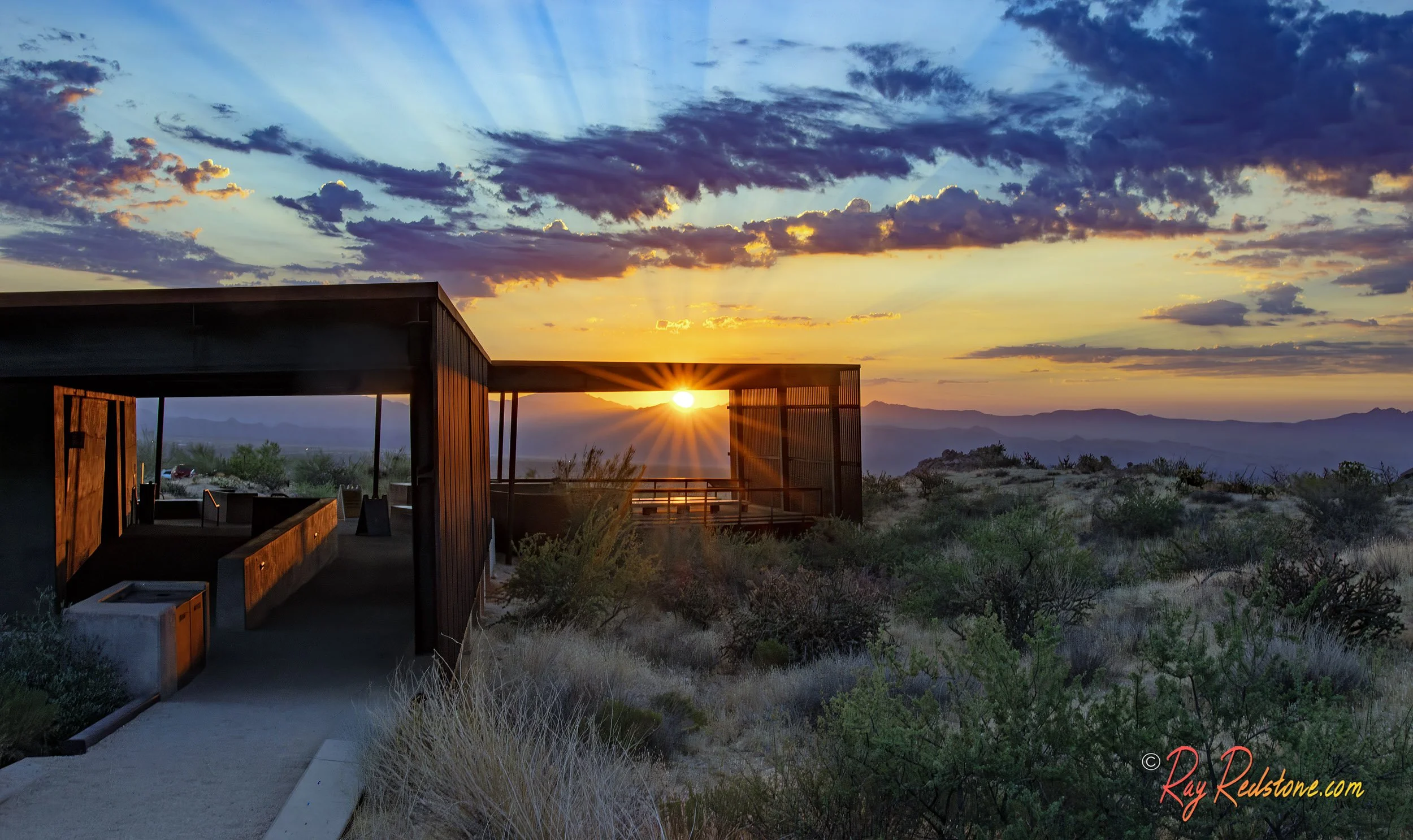
This is a sunrise image of the Toms Thumb trailhead building looking back right where the trail begins. The City of Scottsdale did a great job designing these trailhead structures.
This is your view as you approach the iconic Toms Thumb Rock formation.
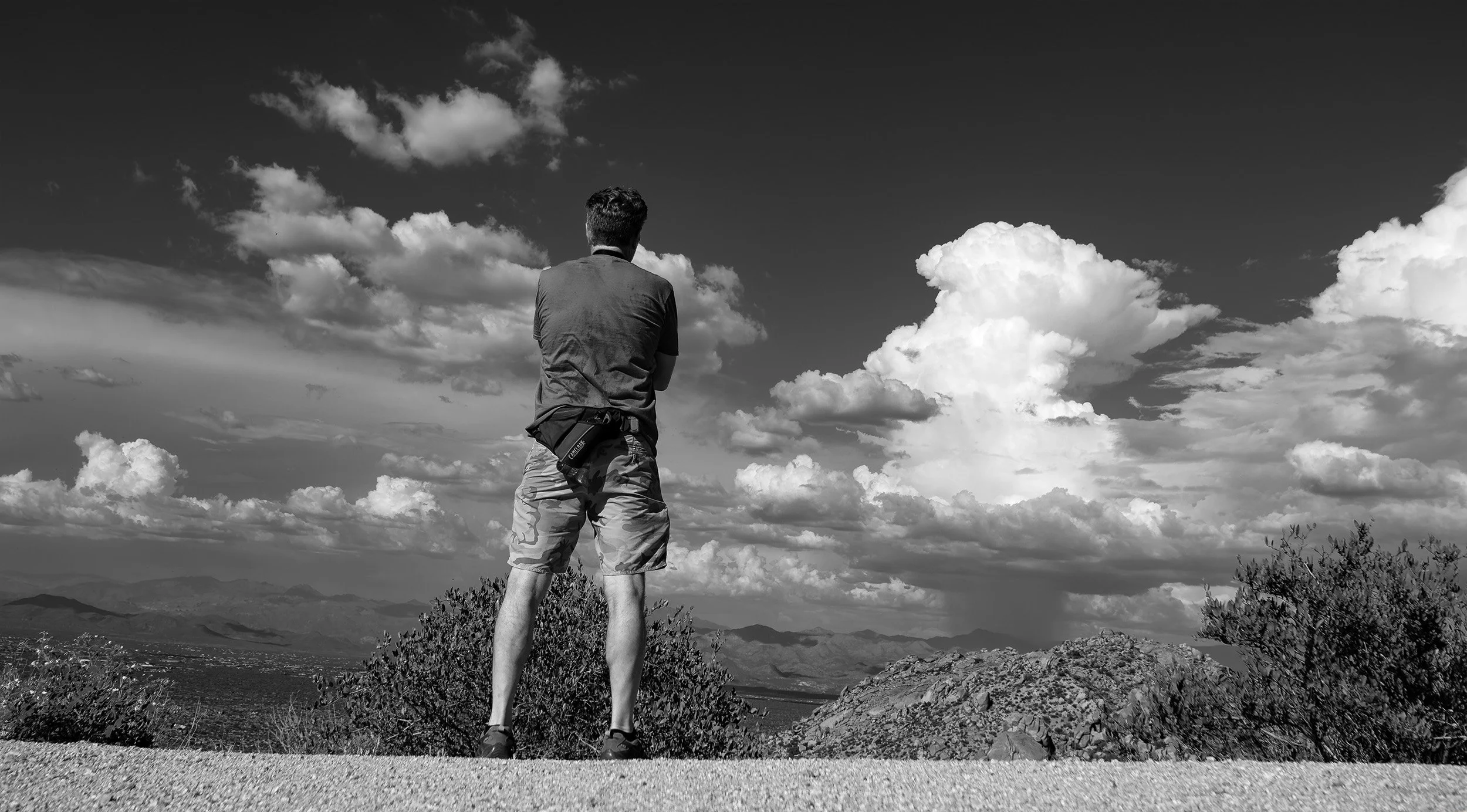
This is the expansive view looking East from the Raven Nest overlook on the trail. Always good to keep an eye out for storm clouds building in the summer months as you can see here off in the distance…
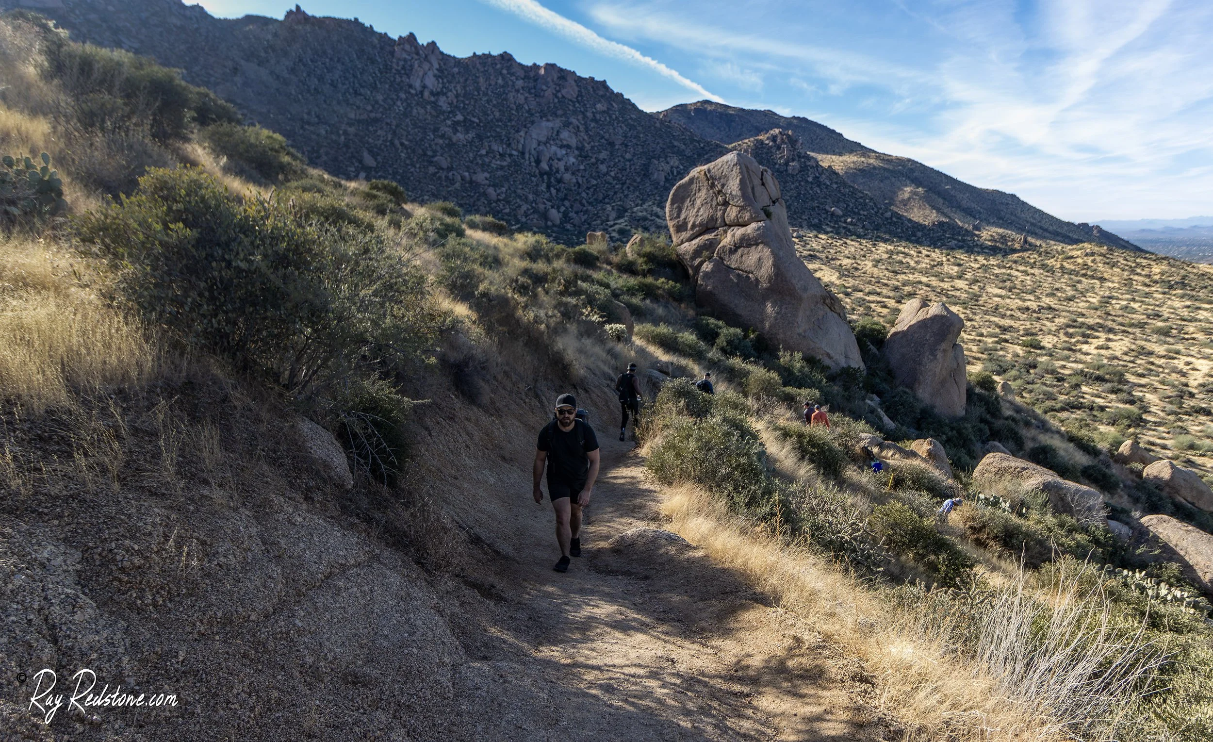
A hiker (my nephew) heading up the trail during late afternoon. This trail can be very popular on the weekends and occasionally crowded during peak seasons…
Approaching the trail ridgeline or saddle after some leg burning switchbacks…
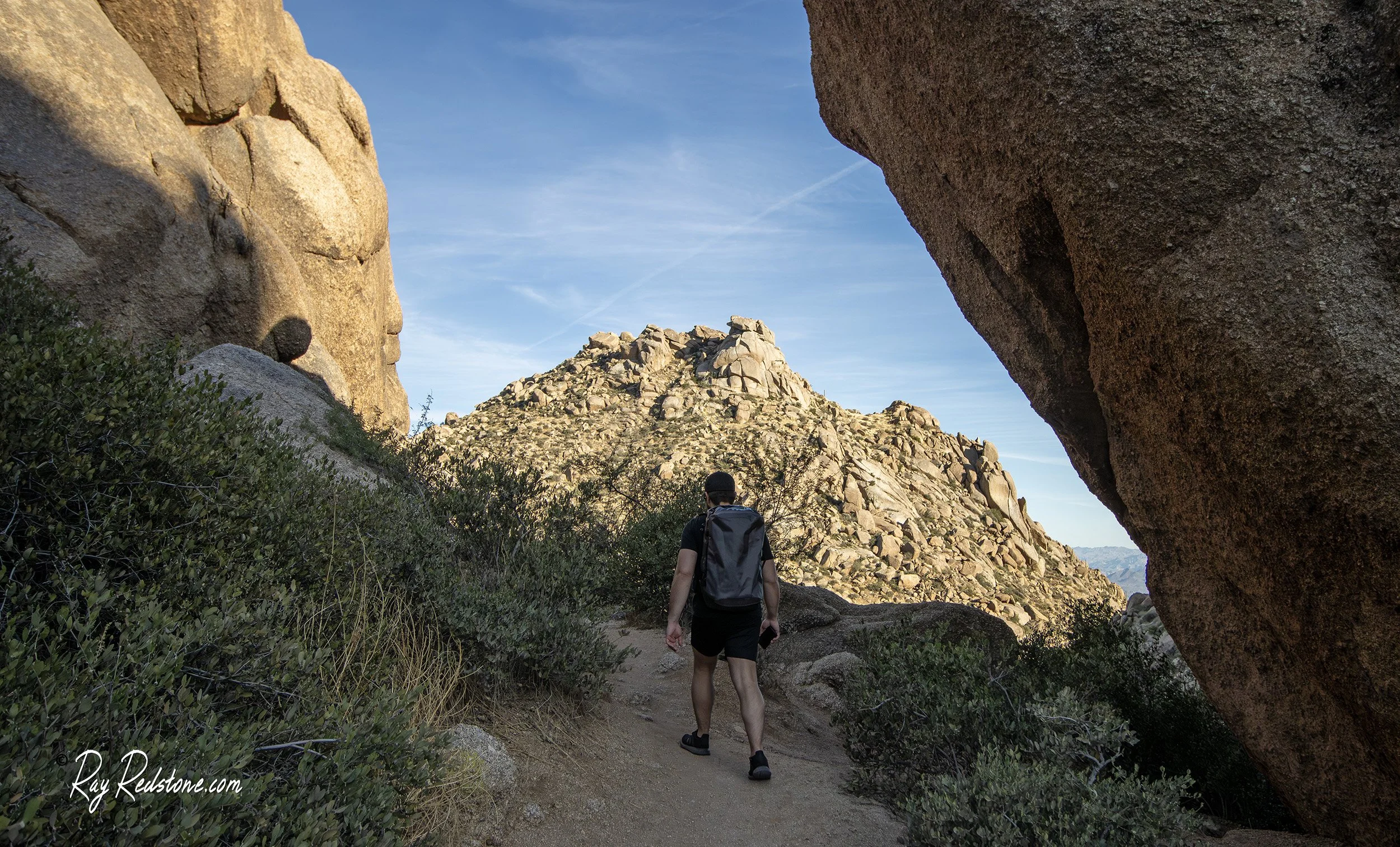
You will encounter lots of huge boulders and dramatic rock features like this narrow pass along the ridgeline portion of the trail….
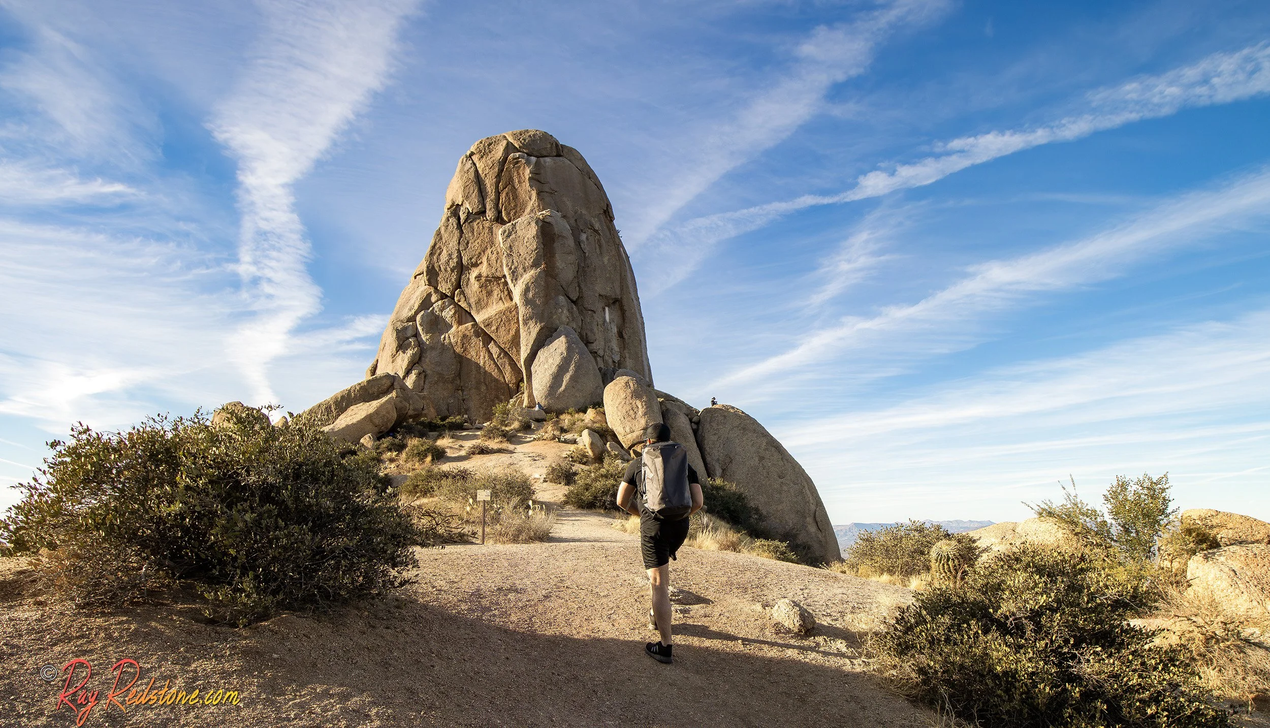
The final approach to the granite Toms Thumb rock feature with is about half a football field tall. The elevation at the summit here is approximately 3,800 feet.
This is a Colorful Gila Monster lizard I encountered along the trail one afternoon. Although they are poisonous, they are not aggressive and very slow in my experience…